
The State of Himachal Pradesh has a geographical area of 55,673 sq km, which constitutes 1.69% of the geographical area of the country. The State lies between 30°22'N to 33°12'N latitude and 75°45'E to 79°04'E longitude. As per the 2011 census, Himachal Pradesh has a population of 6.86 million accounting for 0.57% of India's population. The rural and urban population constitutes 89.97% and 10.03% respectively. Tribal population is 5.71% of the State's population.
Recorded Forest Area (RFA) in the State is 37,033 sq km of which 1,898 sq km is Reserved Forests, 33,130 sq km is Protected Forests, and 2,005 sq km Unclassed Forests. In Himachal Pradesh, during the period 1st January 2015 to 5th February 2019, a total of 959.63 hectares of forest land was diverted for non-forestry purposes under the Forest Conservation Act, 1980 (MoEF&CC, 2019).
The Protected Area network in the State has five National Parks, 28 Wildlife Sanctuaries and three Conservation Reserves, which cover 15.10% of geographical area of the State.
Based on the interpretation of IRS Resourcesat-2 LISS III satellite data of the period Oct to Dec 2017, the Forest Cover in the State is 15,433.52 sq km which is 27.72% of the State's geographical area. In terms of forest canopy density classes, the State has 3,112.71 sq km under Very Dense Forest (VDF), 7,125.93 sq km under Moderately Dense Forest (MDF) and 5,194.88 sq km under Open Forest (OF). Forest Cover in the State has increased by 333.52 sq km as compared to the previous assessment reported in ISFR 2017.
Forest Cover of Himachal Pradesh (in sq km)
| Class | Area | % of GA |
|---|---|---|
| VDF | 3,112.71 | 5.59 |
| MDF | 7,125.93 | 12.80 |
| OF | 5,194.88 | 9.33 |
| Total | 15,433.52 | 27.72 |
| Scrub | 315.28 | 0.57 |
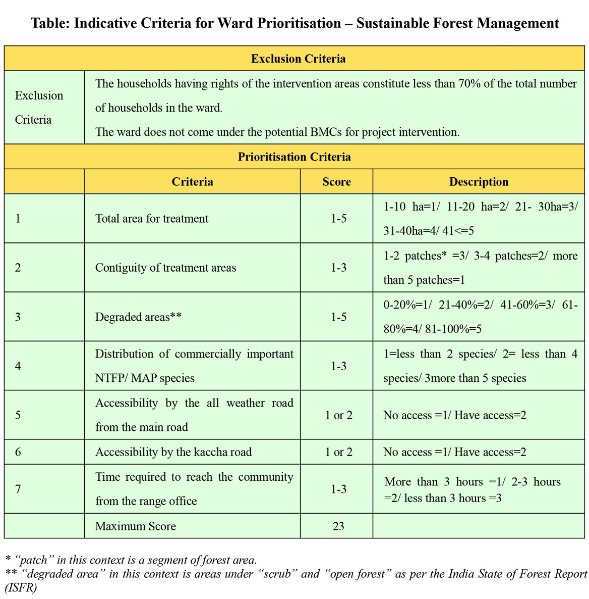
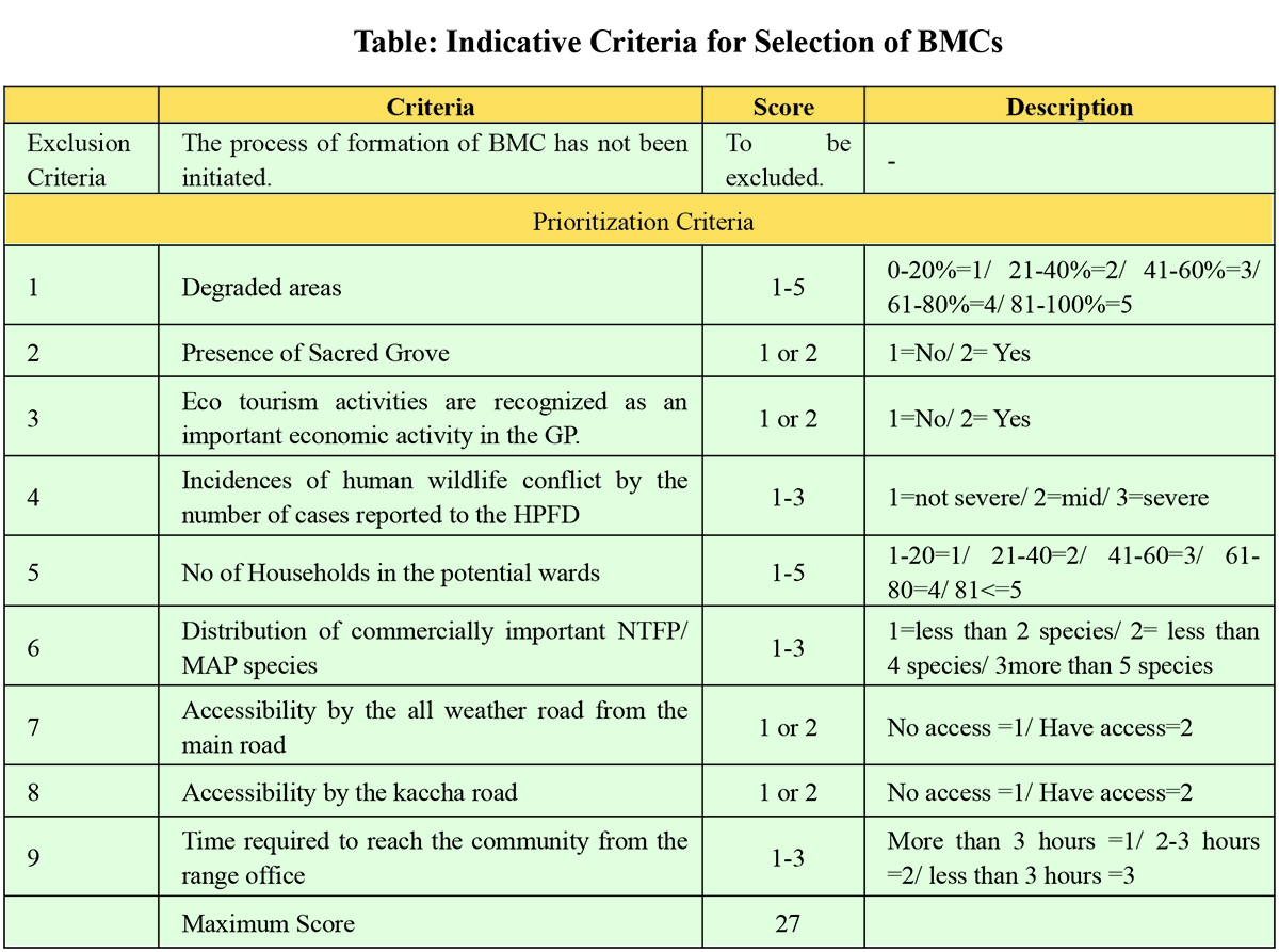
In the PIHPFEM&L, the lowest target unit is GP/Wards which will be selected on the basis of certain criteria for the implementation of the project.
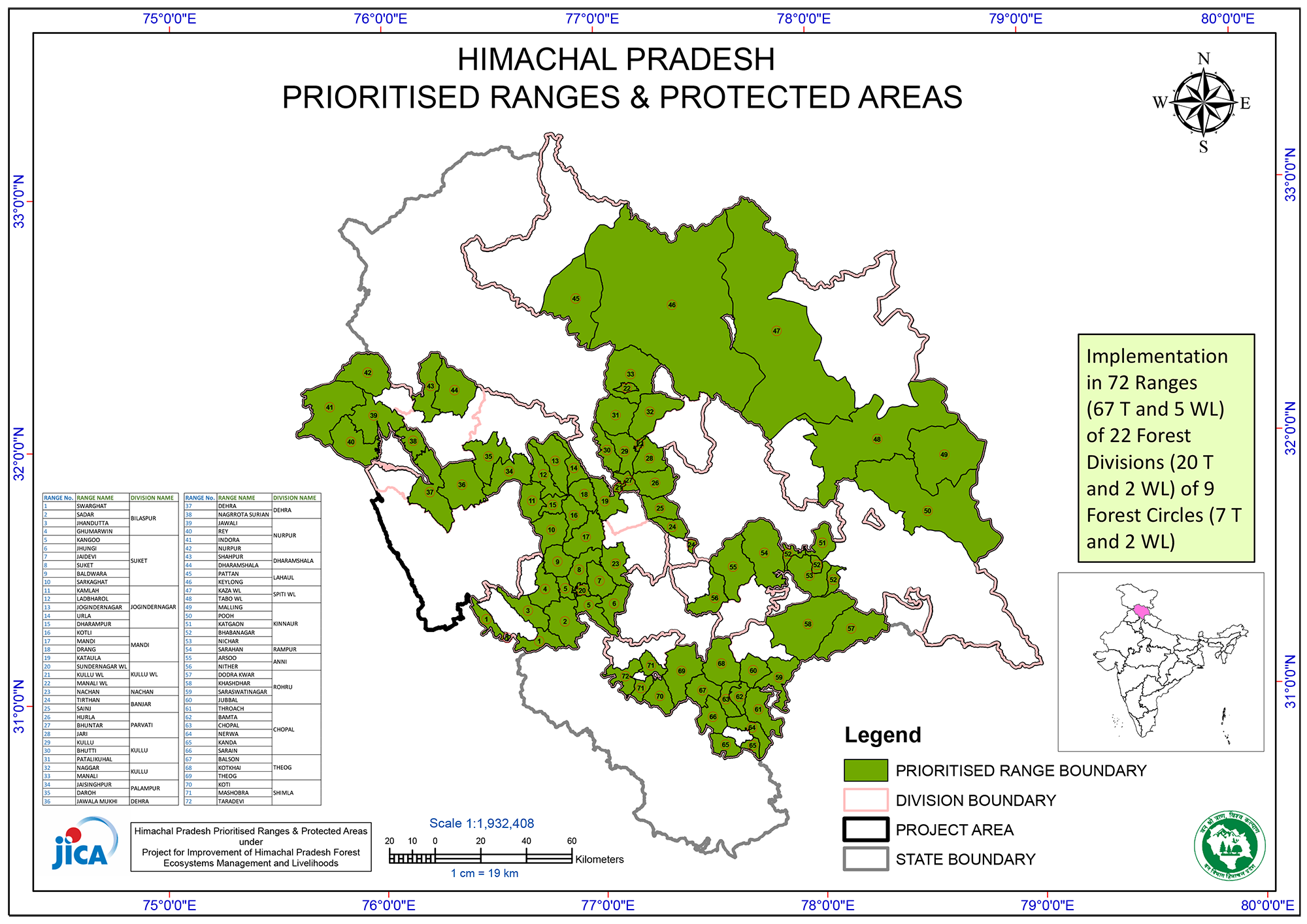
Below is the map outline of the project area which consists 22 forest divisions and these divisions consists 72 ranges.